First Aid Course in Canberra. Make sure you stay safe Canberra. If you need to update your first aid course in the future contact us for some great deals. Book now at www.canberrafirstaid.com
METEOROLOGISTS have warned we are heading into “uncharted territory” as a “very, very big weather event” descends.
ONE of the hottest November months in Australia’s history is about to come to a screeching halt with warnings of a “major rain and flood event” sweeping through the country’s east.
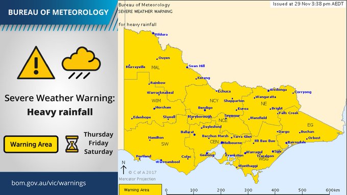
On Thursday morning, the Bureau of Meteorology has issued an unprecedented severe weather warning for the entire state of Victoria. Residents should brace bracing for flooding with storms set to dump 300mm of rain in parts of the state over the next few days.
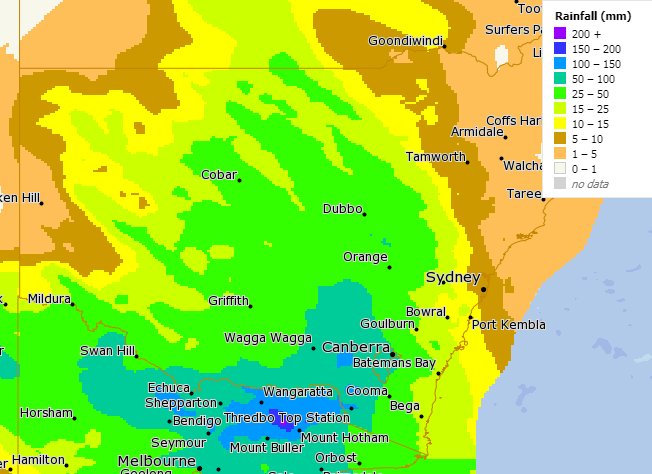
And it’s not just Victoria — just about every capital could get drenched. Parts of NSW are also on alert for “more than a month’s rain in 36 hours”.
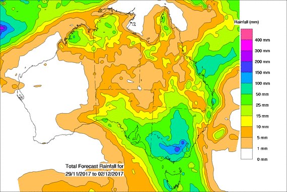
Flash flooding is likely in Melbourne as a low-pressure system dumps up to 150mm of rain on the city between Friday and Sunday, while falls in Victoria’s northeast could top 300mm.
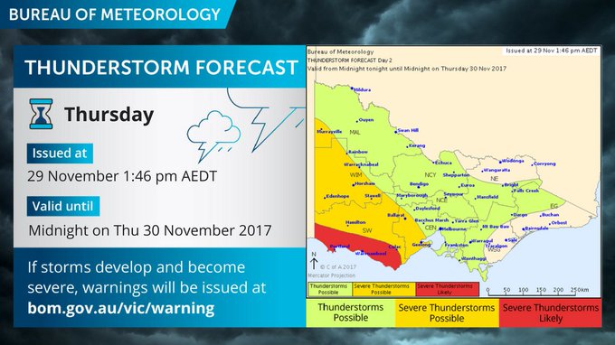
The storms will develop in the far west late on Thursday before extending across the rest of the state on Friday.
The Bureau has called it the “most significant rain event for many years” and issued a series of weather warnings as the big wet approaches.
“This is a very, very big weather event, we are in uncharted territory,” senior meteorologist Scott Williams told reporters on Wednesday.
“We could see six-hourly rain rates of over 100mm over several parts of the state, stretching from the Grampians and Horsham in the west to the northeast and ultimately Melbourne.”
Several hundred millimetres of rain could fall in a band encompassing capitals from Brisbane all the way down to Hobart. It won’t all come at once but it’s likely to be a miserable weekend in many places
As a foretaste, almost 30mm fell in Brisbane on Wednesday with another 30mm due today.
Umbrellas at the ready Melbourne and Canberra, both of which will likely exceed 100mm of rain. Between 50-60mm in the entire month is more usual.
A sodden Hobart could register 70mm over the weekend and into next week, eclipsing the December average of around 50mm of rain.
Adelaide looks like it will see around 50mm, most of that on Friday. Sydney’s mere 40mm of rain means the Harbour City is the least impacted, but Saturday is still likely to be very wet.

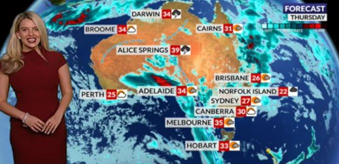
Huge amounts of rain could fall in the next week. Picture: Sky NewsSource:Supplied
Perth, meanwhile, will escape it all with a dry and gloriously sunny weekend.
Before that, we’ve still got to get through an absolutely scorching last day of spring.
Adelaide CBD reached a whopping 39.4C yesterday, its hottest day since March while Melbourne reached 35.8C. Those cities as well as Hobart and Canberra could see highs well into the 30s on Thursday.
“This is a huge week of weather,” Sky News meteorologist Tom Saunders said.
“Before the rain arrives, southeast Australia is ending one of the hottest Novembers on record with another spell of extreme heat.”
Mr Saunders said the unprecedented heat had been due to a blocking high over New Zealand which could be the result of weak La Nina conditions forming over the Pacific.
Last week, the Bureau of Meteorology said it was likely a La Nina weather system would indeed form, but it would not be as strong as previous years.
Then, as December hits, temperatures will plummet as the heavens open.
The forecast is based on the likely outcome of what’s expected to be a weather battle royal.
Very warm and humid northerly air that has drifted over southeast Australia, bringing the current heat, looks like it will clash with cold air moving north from the Southern Ocean.
“Warm air colliding with cold air is a volatile mix and will lead to the formation of a deep and complex low pressure system over southeast Australia on Friday,” Mr Saunders said.
“The low will remain in the vicinity of southeast Australia until early next week and lead to well over a month’s worth of rain in just a few days for some regions,” he said.
WHEN WILL THE RAIN HIT YOU?
A hot 34C on Thursday with some showery spells and then a big drop to 21C on Friday with up to 35mm of rain. Sporadic showers then continue throughout the weekend.
Around 150mm of rain could fall on an absolutely drenched Melbourne over the next few days, starting with a whopping 60mm on Friday alone. Thursday will start off warm, reaching 35C, then as the rains come the, mercury will drop only getting to 19C by Sunday. Persistent falls all weekend.
This has been the hottest November in Hobart since records began. Tasmania’s hot run continues until Thursday when the mercury will peak at 33C. Friday will then see the mercury drop by 10C to 23C with up to 35mm of rain, setting the tone for the weekend. Highs of around 16-18C for Saturday and Sunday.
A high of 30C on Thursday dipping only a touch to 29C on Friday with storms a possibility and heavy rain. But it’s Saturday that’s going to be really wet with up to 60mm of rain and the dial getting to 23C. Temperatures will then continue to drop further with further, often heavy, rain into next week.
Sydney will escape the wost of the downpours and temperatures will remain relatively stable at around 27-29C throughout the weekend. But it will still rain, heavily at times, with Saturday the wettest day. Showers will continue into next week.
Up to 30mm of rain could fall on Thursday with temperatures around 25C. The rain, albeit less heavy, will continue into the weekend as the mercury rises to 29C. A stormy Sunday and Monday could see the heavy falls return.
34-35C across the Top End with sunshine and storms but rainfall below many of the other capitals.
Never one to play the east coast’s game, Perth will be a model of summertime weather this weekend. Clear skies every day, temperatures will rise from a mild 25C on Thursday to 36C on Sunday.
When these events happen it is best to be ready, get yourself trained in a first aid course asap.


